more below ↓
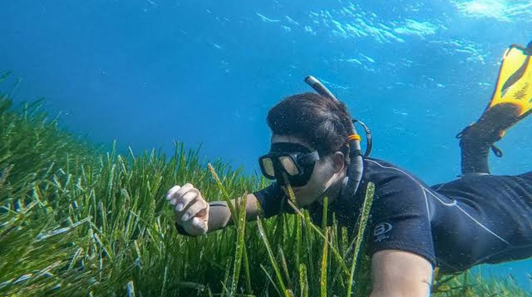
A snorkeller swimming over a living Posidonia meadow off the Cilento coast

01 Island Lab · August 2026

The People's Posidonia

Shaping demand to develop the Blue Economy. Pollica, on the Cilento coast.

Island Lab · Sean Kolk and Kate Schnippering · sean@islandlab.dev · islandlab.dev
Posidonia oceanica off Acciaroli, July 2026.

02 The problem

The solutions are already on a shelf

Science and institutions have produced the protocols, the methodologies and the protection zones. Three things keep them there.

Nobody local is asking for them

Nothing is implemented on a coast until the people who live there want it. That demand is the part nobody is building.

The coast cannot see itself

A night's fishing off Acciaroli leaves about thirty euros. Forty years of knowing where the meadow thins goes home with the boat and stops there.

Protection is cheap and unfunded

Mediterranean Posidonia conservation needs about 336 million euros a year and receives about 17 million. Five percent of the need is met.
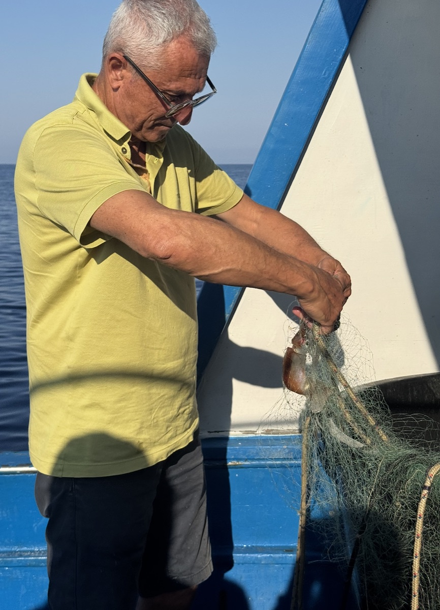
An elder fisherman clearing a cuttlefish from his net in the morning light
Vittorio leaves at one in the morning · forty minutes out to set the nets
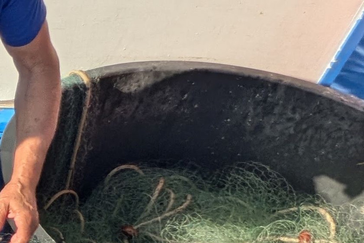
The nets being worked over the side of the boat at dawn
Forty years of this coast · where it is thinning, where boats anchor
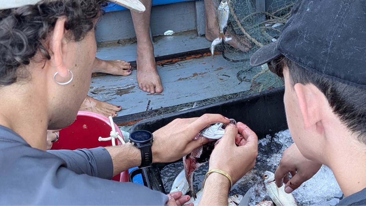
Crew and students measuring the morning catch on deck
The catch lands · the day's knowledge goes home with him
no photograph exists
of this moment
Nothing records any of it · a dragged anchor, a thinning patch, a bloom. Seen, and then forgotten

evidence ledger the week this came from

The cost of repair, the cadence of knowing, and where the thirty euros comes from

Passive conservation runs 38 to 58 euros per hectare per year (ARTEMIS 2025 page 11, from recent Balearic data), against active restoration at 516,000 to 942,000 per hectare (Bayraktarov et al. 2016, at 2010 prices) and 2.5 million for a 2024 Balearic project. The comparison sets an annual cost against a one-off cost, so it is stated that way rather than as a like-for-like multiple. ARTEMIS names passive conservation the most impactful and efficient approach for seagrass, and lists its mechanisms as eco-moorings, ending illegal anchoring, verified pollution reduction, and surveillance and enforcement, which is what the survey protocol produces. Posidonia grows about a centimetre a year, so a meadow lost is lost on a timescale of centuries.

10 100 1 000 10 000 100 000 1 000 000 Protect a hectare, every year 38 to 58 Rebuild a hectare, once 516 000 to 942 000 euros per hectare, logarithmic

And the knowledge arrives on a five-year cycle. Producing one extent survey takes a local community, a local company, Rome and several universities. Patrol, anchoring decisions and any avoided-loss claim turn over inside a season.

What the coast is asked to decide, monthly What the survey delivers, in the same sixty months 0 yr 1 yr 2 yr 3 yr 4 yr 5 yr

The thirty euros was stated by the fishermen of Acciaroli during the People's Posidonia week in July 2026, as the typical profit left after fuel and the broker's cut. It is a reported figure from the people who earn it rather than a survey.

03 This already works

Communities that hold their own coast

Marine stewardship run by the people who fish is real, measured, and Mediterranean. Three cases, three ways of holding a seabed.

TORRE GUACETO
PUGLIA, ITALY
Fish populations up roughly fourfold. Catch inside the reserve roughly double outside. Two municipalities and WWF Italia manage it jointly; the fishermen sit on a permanent co-management roundtable with scientists and authorities. Seven boats, once a week, to a protocol they helped design.
KERKENNAH
TUNISIA
Customary sea tenure, inscribed by UNESCO in 2020. Families hold named fishing sites worked with fixed palm-frond traps that take fish without dragging the seabed. Held by inheritance, and by sale and annual auction.
MIKOKO PAMOJA
GAZI BAY, KENYA
Community-held carbon since 2013, on 117 hectares. Co-management and user rights under the national forest agency, certified by a standard that requires at least 60 percent of credit income to reach participants and local stakeholders.

Pollica is that shape, on Posidonia, in Italy. evidence ledger

What each case proves, and what it cost them

Torre Guaceto closed entirely from 2001 to 2005, then reopened to a licensed artisanal fishery in the partial-protection zone. The recovery figures are stated independently by the European Commission and by the reserve, resting on Guidetti et al. 2010 in Fisheries Research. The fishermen became the enforcement layer, reporting poachers to the Coast Guard, and in 2023 volunteered a further month of closure and backed expanding the protected area. Then all fishing was suspended from May 2024 to December 2025 after an illegal-fishing crisis that the consortium director said risked undoing twenty years of gains. Video surveillance, a faster Coast Guard dock and concrete anti-trawl structures followed. Whether the licensed fishery has resumed is unconfirmed as of August 2026. The lesson is the one this proposal rests on: co-management produces recovery, and it holds only with the capacity to see and to enforce.

Kerkennah is under the same pressures Pollica faces. Illegal trawling in the district rose about 40 percent between 2018 and 2022, fishermen report catching roughly a quarter of what they caught thirty years ago, an invasive blue crab damages the traps, and young people are leaving. The tenure is real and recognised; it is also eroding. No study measures the fishery's effect on Posidonia, so it is passive by design rather than proven harmless.

Mikoko Pamoja is the financeable structure. The community organisation is one of twelve user groups under an umbrella forest association holding a management agreement with the Kenya Forest Service; the land stays state-owned. Community teams monitor on marked plots and run scout surveillance, a research institute provides the technical layer, and independent verification runs on a five-year cycle with annual reporting between. Research from about 2010, established 2012, crediting from 2013 to 2033.

04 What is being offered

The fleet becomes the instrument

The boats already go out. The method, the tooling and the quality control turn a working morning into evidence a scientist or an auditor can use. The community holds the record.
cost model impact over time

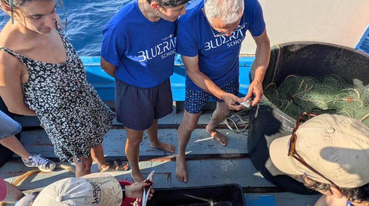
An elder fisherman on his deck with two students, all three handling the same fish
The pairing · forty years of the coast, and the phone that records it
TODAY WITH THE PROGRAMME Who watches the coast distant institutions, every five years the people on it, every month What a day on the water pays 30 to 100 euros, fishing 200 to 300 with visitors, and 50 more surveying What scientists work from models and episodic dive days ground truth, and where to dive next What the community holds nothing that outlasts the day the record, and the sign-off on it What can be acted on a nine-year-old polygon this season's map Who is involved a handful, informally 1 655 by year ten, in a town of about 2 000
three conditions, and all of them have to hold

Feasible: the data survives scientific review. Viable: it pays for itself. Desirable: people trust it and act on it. The three units that follow take one each.

Why the shift is already underway, and why the pairing is the design

Vittorio already earns more from taking people out than from fishing. Nothing has to create the transition from extraction to stewardship: the decline of the fishery and the arrival of ecotourism have already begun it. The survey is not a vessel hire, it is a marginal addition to a day that is already funded, which is why the network can plausibly sustain itself. The capital item is the instrument rather than the labour: side-scan sonar is about 8,000 euros per boat.

The pairing is the interface. These are people who barely use phones, so an interface complex enough to be useful would be complex enough to be abandoned. The fisherman never touches a complex screen; the student does. The fisherman brings forty years of knowing where the meadow is, the student brings the phone, and neither works alone. That is why the school partnership is load-bearing rather than decorative.

The split is deliberate: Island Lab supplies the method, the tooling and the quality control, and the community owns the data. That is what makes the monitoring independent of the parties being monitored.

05 Feasible · will the data hold up

One run, end to end

A boat that was going out anyway comes back with a record. A student makes it legible. Within the season the comune can act on it, and the scientists know where to spend their dive days.
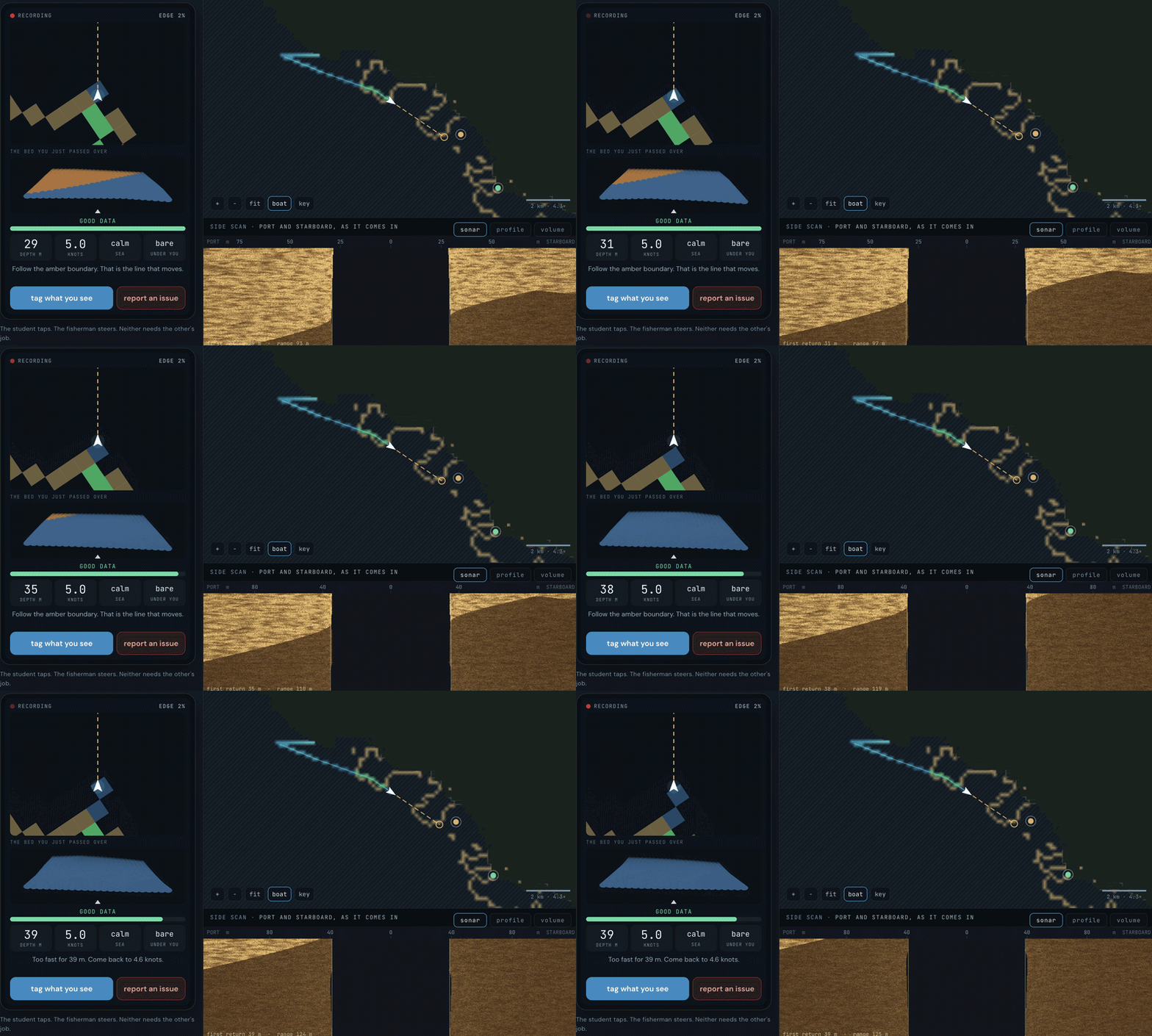
one morning, and what changes because of it THE BOAT runs a line it was running anyway THE STUDENT records what passes underneath THE COAST has a current picture of itself THE SCIENTIST is told where to dive next THE COMUNE can act inside the same season and what changed sets next month’s line
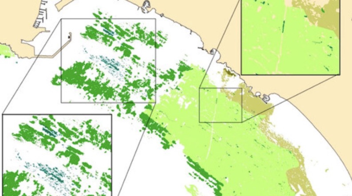
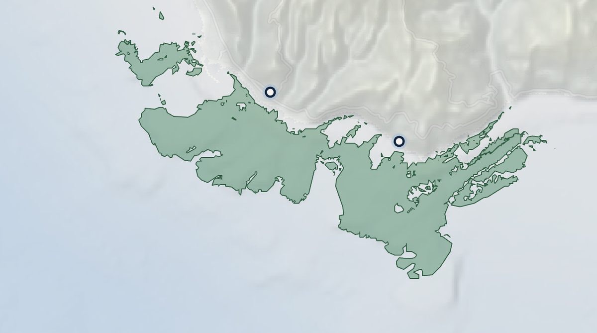
The 2017 extent map, a flat polygon of meadow along the coast
What exists today · extent mapping. Present or absent, once
The route view showing an assigned survey line along the coast
What is being added · routes run locally, every month
A high-resolution habitat map showing density variation and breakup
What good looks like · how much, in what condition, where it breaks up

periplus ecosystem map meadow futures the whole stack

The kit, the four screens, and who consumes what the fleet produces

The kit: side-scan sonar, temperature and salinity sensors, GPS tracks, photogrammetry and drop cameras. The four screens: route, here is today's water; monitor, capture as the boat goes; protect, flag an anchor over meadow and route it to authority the same afternoon; predict, the whole area and what a level of protection buys.

The software behind each step, for anyone who wants to open it. Planning and running the line is Periplus. Telemetry and provenance is Triton. The living extent and condition is the ecosystem map. The comparison against what was expected is Meadow Futures. The names matter to whoever maintains them and to nobody else; what matters here is that each one opens and runs today.

One fleet, three consumers. Scientists and labs get where to dive next and ground truth to compare models against, so limited dive days go where the meadow is actually changing. Restoration investors get a provenance-grade baseline and the stretches that do not need replanting, which for millions deployed is worth more than the map. Verification gets continuous measurement instead of periodic survey, with every point carrying a vessel, a route, a timestamp and a named operator, which is the audit trail a verifier asks for.

The extent this works against is 5,310 hectares across the Cilento coast, or 1,075 within Pollica's own bounds, both computed from the ISPRA features and both re-runnable. Which footprint the programme covers is an open scope decision. The return edge of the loop, carrying returns through to the map that sets tomorrow's route, is what the first phase closes.

06 Viable · does it pay for itself

Grants buy the network. Earned revenue runs it.

Commons management funded between tourism and aquaculture, with credit revenue as one component rather than the whole answer.

PROOF OF CONCEPT PILOT SCALE Grants and public spend Student education fees Visitor attendance Mooring fees Sustainable tourism levy Credit revenue share solid, carrying it · faint, partial
13,403 euros to stand up

Six sensor units, one side-scan rig, ground-truth kit and mobilisation.

24,382 euros a year to run

Teaching is 55 percent of that and the platform is 2.4, so the expensive part is people. Per hectare the cost roughly halves as the footprint widens.

cost model, line by line investment programmes

The ten-year model, the credit lines and what is deliberately not costed
this figure is not yet defensible and is shown as an open item

A ten-year model carried in earlier material returns 1.75 for every euro in, on 5.6 million invested against 9.8 million returned, breaking even in year two. Its workings do not exist in writing. It also sits about six times above the sum of the three phases costed on this page, which is under 900,000. Until it is rebuilt from the cost model upward it should not be used, and it is named here rather than quietly dropped because it has already appeared in material that went out.

The credit lines. Carbon at 24 euros per tonne of CO2e (band 11 to 27) gives 9.84 per hectare per year at 0.41 tonnes durable. Biodiversity adds 150 per hectare per year (band 50 to 500). Stacked at 159.84, that is a ceiling near 172,000 a year across 1,075 hectares or 849,000 across 5,310. Ceilings gated on verification being funded, not forecasts, and the honest band is roughly tenfold. Carbon was carried at 40 until it was sourced properly; the sourced central is 24, and that correction is stated here because a number revised downward with its band showing is worth more than one that survives until someone checks it.

Verification and MRV carries no figure. No Posidonia credit has issued on any registry, so there is no verifier fee to derive one from and inventing one would undo the point of the rest. The headroom instead: below about 147,000 a year at the Pollica footprint the central case still covers its operating cost.

The separate figure of 86,000 euros per hectare per year is a 2024 French court ruling reported via WWF MMI 2025 in ARTEMIS 2025. It is a judicial valuation of harm rather than capturable revenue, and it is not a credit price.

07 Desirable · do people trust it

A nonna is not going to open a laptop

Publishing data is not the same as making it public. It has to be somewhere with a person standing next to it, so the map goes where people already are.
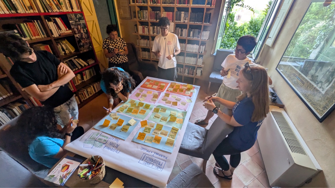
A community workshop around a table covered in written notes, in a library
The workshop · where the community wrote what it wanted the coast to become
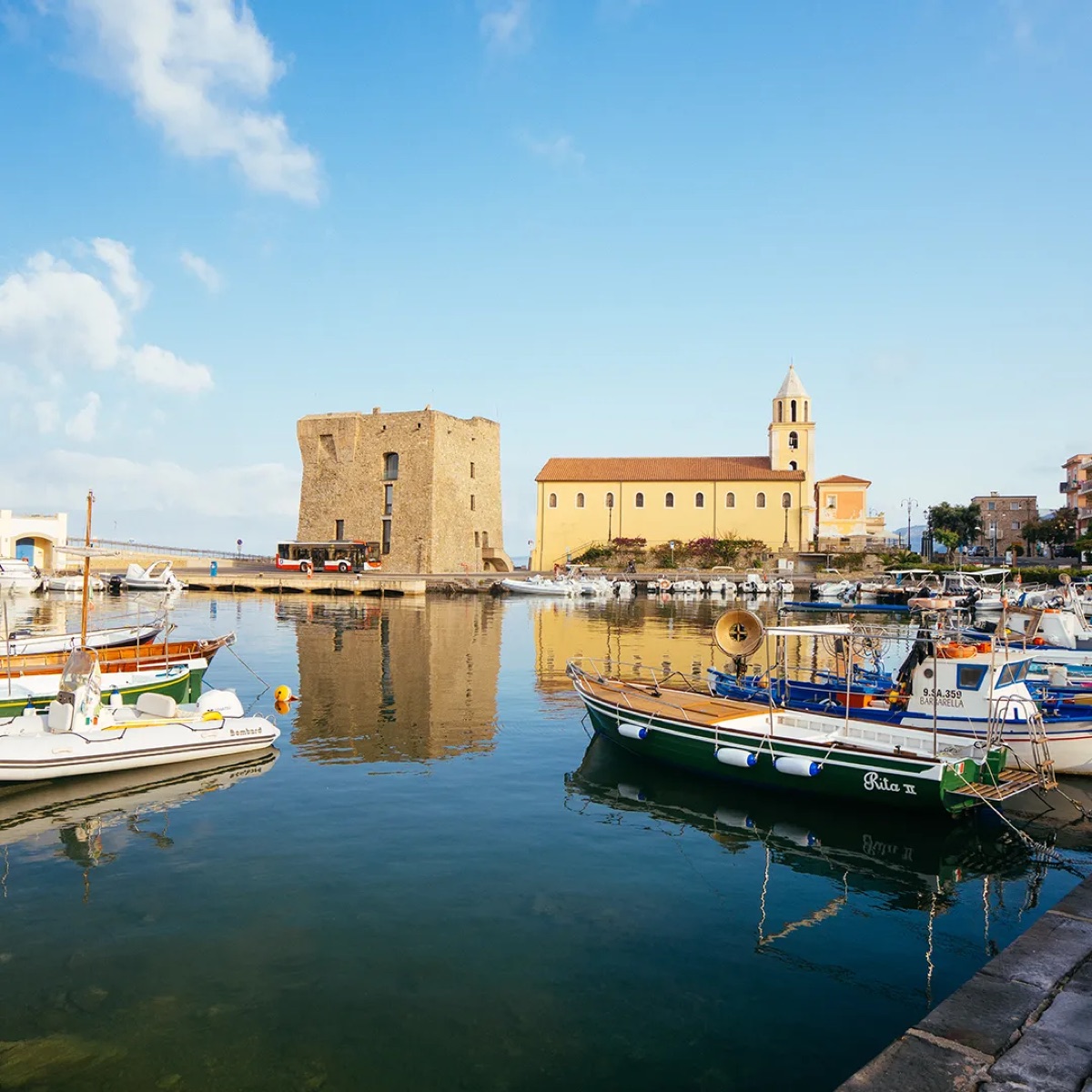
Acciaroli harbour with the tower and moored fishing boats
The Castello and the museum · a permanent public view of the coast's own map
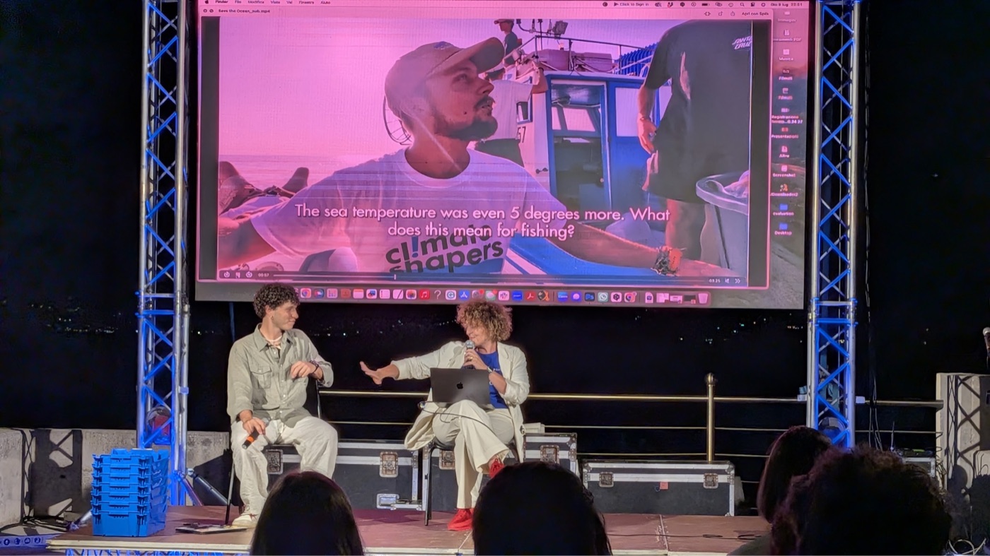
A documentary screening on a stage with an audience
Viviamo Cilento · the map as the centrepiece, and people find their own bay
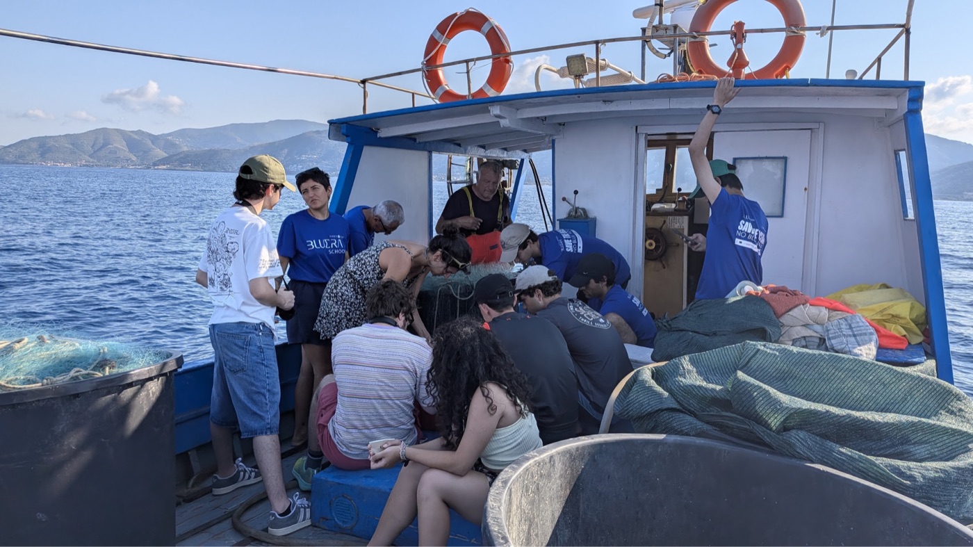
A full student cohort aboard a working fishing boat with the skipper
Fishermen and families · the people producing the evidence see what it added up to
somebody has to run this

Routes set, boats coordinated, returns reviewed, the public side kept alive. A paid local coordinator is the first line of the proof-of-concept budget rather than an overhead on it.

What the campaign is for, and what it has already produced

The strategic payoff is local advocates acting on their own behalf instead of waiting for a regulator. When a coastal group can see its own water and trust the numbers, that is the difference between compliance and stewardship, and it is what a funder is actually buying.

Already made: a youth-led short documentary linking the hidden seagrass to local heritage, slow food and the Mediterranean diet. In development with the community: the key messages, deliberately shaped there so the language belongs to the coast rather than to us. The Living Museum of the Mediterranean Diet at Pioppi, the Castello at Pollica and the BLUERA centre at Acciaroli are the standing venues; Viviamo Cilento is the moment.

08 The landscape

A methodology exists. The market is still forming.

Several Mediterranean pilots are generating the data that shapes the early market. Pollica would be among the first in the world to run one continuously and locally.

NICE, FRANCE
PosBacia25, 6,500 ha, labelled July 2025 under Label Bas-Carbone. The first Posidonia project labelled anywhere. It verifies at years five and ten, so its earliest issuance is 2030.
MENORCA · SARDINIA
Active and passive restoration, anchor removal, and payment for ecosystem services tied to yachting and tourism fees.
CRETE · MONFALCONE
Restoration after fish-farm impacts, and links to port operations and industrial mitigation in the Gulf of Trieste.
ITALY, THE STANDARD
An EU LIFE project whose partners include ISPRA and CNR built a Posidonia carbon methodology, and ran one of its three study sites inside the national park Pollica belongs to. Italy's national voluntary registry opened in October 2025 with a forestry scope.

Entering now is early rather than late. certification, ledger row C1

What crediting will require, and where the advantage sits

Label Bas-Carbone sets three tiers: extent and health monitoring by satellite; carbon stock quantification by divers coring the matte, which is the long-term storage and varies greatly; and dynamic accounting of whether conservation is having an effect. Participation requires a traceable chain with third-party audits about every five years, running from meadow health measurements to actions taken to avoid degradation to the credit claim. Higher quality data means higher credit value.

That is the shape of the advantage. Survey capacity is the one input in a blue-carbon project that gets cheaper the more local it is, and continuous community monitoring paired with periodic professional coring is the structure that satisfies both the annual and the five-year requirement. It is also the Mikoko Pamoja structure, working since 2013 on a different substrate.

09 Who does it

Five functions, and who holds each one

The fleet and the students collect. Island Lab holds method and quality. Academia validates. The comune signs off on what enters the public record, and acts on it.

COLLECT QUALITY VALIDATE SIGN OFF ACT Fishing fleet BLUERA students Island Lab Academia Comune di Pollica * filled, holds it · open, supports it · * proposed, not yet discussed with them
Island Lab

A limited liability company registered in Washington State, founded by Sean Kolk and Kate Schnippering. It supplies the method, the tooling and the quality control. The right receiving vehicle for an Italian municipal programme is an open question worth settling together.

Already engaged

BLUERA and the Paideia Campus, the Future Food Institute, and academic partners on this coast, each engaged with the Pollica work rather than with this proposal. Separately, and independently of us, Pollica has run its own coastal protection measures for over a decade.

stated as a proposal

This is the split being proposed, not an agreed one. The Pollica administration has not been approached about this programme and nothing here should be read as their commitment.

Why sign-off sits with the municipality

A record owned by a project ends when the project does. A record held by the comune is one a community can act on and a verifier can audit, and it is what makes the monitoring independent of the parties being monitored.

The closest working example is Torre Guaceto, where two municipalities and a conservation organisation manage the reserve jointly through a consortium and the fishermen sit on a standing co-management roundtable alongside scientists and authorities rather than being consulted by it.

10 Where it stands, and what the money buys

Three phases, against a date nobody here chose

The relationships exist, the boat exists and the first data exists. What has not run is one complete loop on real returns.

SEP 2026 Viviamo Cilento OCT 2026 proof of concept DEC 2026 campaign pilot opens APR 2027 monitoring and patrol pilot JUL 2027 America's Cup, Naples the last date is not ours, and about 10 000 boats come with it
PROOF OF CONCEPT
~3 MONTHS
40,000 to 70,000 euros. Six units in the water and one complete surveyed footprint with ground truth. Proves that fleet-collected data survives scientific review and that the pairing works on the water.
PILOT
~12 MONTHS
90,000 to 180,000 euros. A full annual cycle, a repeat survey producing change rather than a snapshot, a paid local coordinator, and a commissioned verification scoping study.
SCALE
~24 MONTHS
350,000 to 650,000 euros. The Cilento footprint, verification engaged for real, and credit revenue sharing back to the fleet that produces the evidence.

what has already run the loop, demonstrated sean@islandlab.dev

What is built, what has run, and what is still open

Built and running: the ecosystem map integrating ISPRA extent with open ocean models, the survey planner, the scenario tool, the investment board, and the trust layer that attaches provenance and uncertainty to every reading. All of them open at their own addresses.

Not yet run: a survey on real returns, end to end, on this coast. Two outings have been made and the protocol has been demonstrated on generated data. Closing that is what the first phase is for.

Still open, and better said than discovered: the receiving entity for an Italian programme; the cost of verification, which is uncosted because no Posidonia credit has issued to derive a fee from; and four cost lines derived from comparables until local figures replace them.

the map contact

Contents

→ next · ← back · C or Esc close · Home first · End last. Each slide has its own URL, so any single point here can be sent as a link.